|
|||||||
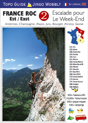
FRANCE ROC 2 - EST-East
ESCALADE pour le WEEK-END
This is the SECOND rock climbing book in our series FRANCE ROC, and it includes a massive 256 cliffs spread across 17 departments in the East of France. The concept of the FRANCE ROC series, is give climbers a practical and portable/compact guidebook, that makes a fantastic selection of cliffs which appeal to the majority of climbers. It is designed for everyone looking for somewhere else to climb at the Week-End, other than their local area. If you want to have FUN at the Week-End, this is the book to get you going.
250 CLIFFS
There are literally thousands of cliffs in East France, however, many are completely inaccessable, others have very poor rock quality, and lots are so devoid of holds there is nothing below 8a going to be possible. There are around 500 excellent quality cliffs in this region that have been equipped with bolts, and I have selected to what I consider are the best 250, that will appeal to climbers looking for; nice location, good range of routes in all levels, FUN picnic possibilities, and nearby pleasant campsites.
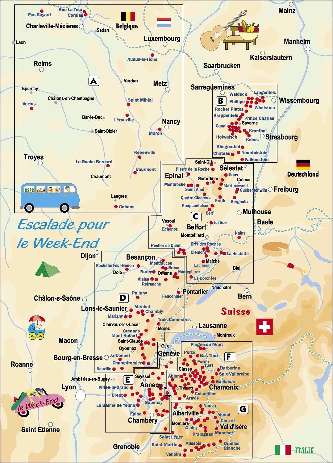
7 AREAS
The book is sub-divided in to 7 large areas that are practical for climbers - see map below. These areas do not follow any political or departmental boundaries, they are simply where there are cliffs near to each other.They naturally form areas that climbers would visit for a week-end, and offer a good selection of cliffs to choose with different temperatures and weather conditions during the year. Each area in the book has an excellent overview map, with a full data page opposite that gives all the important information to easily select the cliff for the day. Information such as number of routes in each grade, drying times, amount of shade, style of climbing, proximity to campsites, supermarkets and occoasionally key petrol stations. Opening times of campsites are given - but be sure to check with the campsites own website - especially if close to the opening-closing dates.
DESIGN LAYOUT
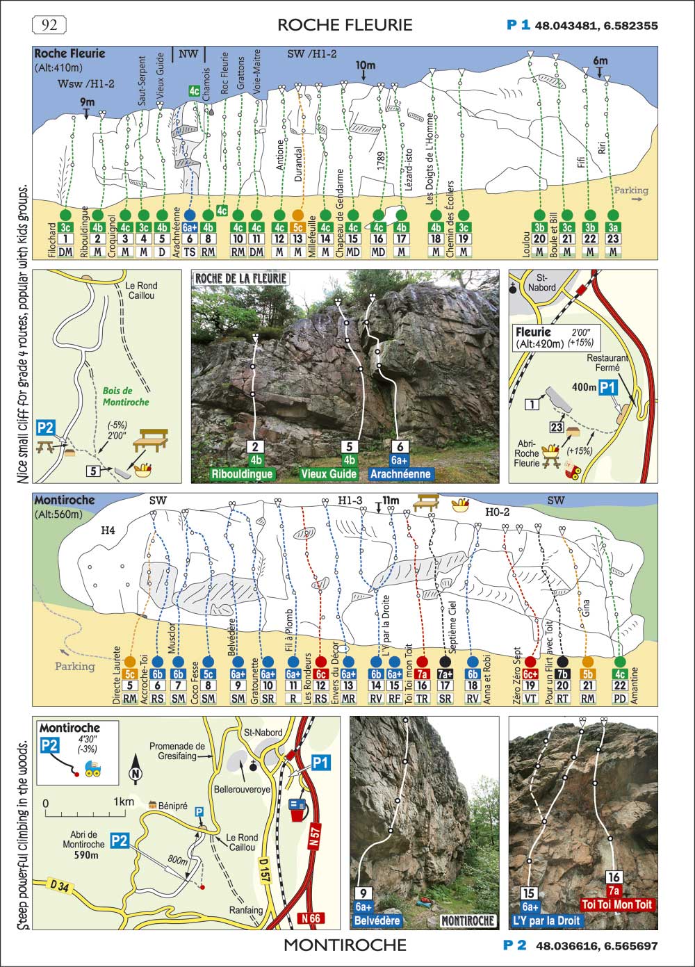
The design of the book is compact, and tries to illustrate the majority of cliffs on a single page. Each cliff has an excellent map for finding the car park - along with decimal GPS co-ordinates. Most cliffs will have a secondary map to get you from the parking to the cliff. Photos are then used so that you can be sure to identify the key features of the cliff, and link up with the graphics so that you can be 100% sure of the route recognition. All routes on the topos are given their historic sport grades, but are also coloured in the classic Fontainebleau colour system that uniquely covers grades. Very big cliffs are only partially included since it is expected that most climbers will enjoy buying the local guidebook if it is available. (Sample of 2 cliff page below map)
JINGO WOBBLY BOOKS - COPYRIGHT: All the photographs in our books are copyrighted, along with all the text and topo drawings. We visit all the cliffs included in our books, and make all the topo drawings ourselves by hand.
.
|
International topo guidebook
FRANCE ROC 2 - EST - EAST ESCALADE POUR LE WEEK-END First Edition - ISBN 978 1 873 665-08-4 36.00 Euros 320 pages, 210mm x 151mm Two languages: French & English Graphics and photo topo guidebook that will suit all levels of climber, beginners to grade 8. 256 Different climbing locations 12000+ routes. Grade 4 (1391 routes) Grade 5 (2389 routes) Grade 6a-6b+ (3486 routes) Grade 6c-7a+ (2847 routes) Grade 7b-7c+ (1413 routes) Grade 8a-8c+ (537 routes) |
|
|||||||||