 |
|||||||
|
|||||||||||||
|
|||||||
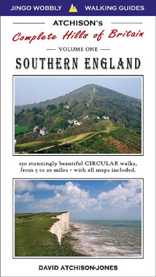
ATCHISON'S WALKS - THE COMPLETE HILLS OF BRITAIN
Volume One - SOUTHERN ENGLAND
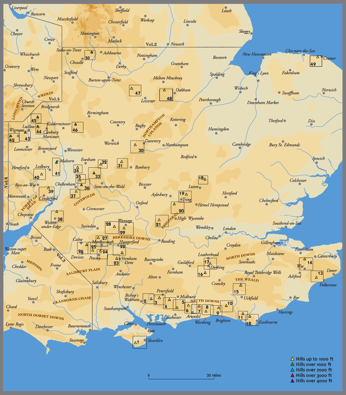
This book covers a very large area and includes all of the substantial hills to be found in the South East and Central parts of England. The aim for each book in the series is to contain 50 good hills to ascend, and hence the somewhat expansive coverage from the South Downs up to the beginning of the Pennine Hills. Enjoyably, it does cover a wide and diverse area, and will offer you plenty to explore without having to worry if you have the correct maps with you.
The Northern part of this book includes some very attractive areas - such as the Clent Hills near Birmingham, Clee Hills near Ludlow, and Northampton Uplands - all surprisingly hilly and offer very good days out. The Central area covers the Cotswolds, Marlborough Downs and Chilterns - quick to access via the M4 & M40 from London, Birmingham or Bristol. The South and North Downs are extensively covered, and the Isle of Wight is also included.
All of the hilly areas chosen for this book have been selected on the basis that they offer enough open countryside for a substantial 5 hour walk, and that there is a substantial summit which offers an excellent viewpoint. There are no giant 4000ft hills of course in Southern England, but we hope that you will like the selection of the 50 different areas chosen. Every area is listed below, and has a brief title as used in the book. There are a total of 160 hills ascended by all the routes in the book, which pretty comprehensively covers the region.
SOUTHERN ENGLAND - MALVERN HILLS 15 PEAK CHALLENGE
This is the finest challenging walk in the book, and is a tremendous day out. It passes over 15 separate summits, contains 3248 ft of ascent (990 metres) and is 18 miles long (28.7km). The route is a spectacular day out and gets a non stop walking time of 5.58 hours. Expect to take 8 hours with rests.
Hill Running: Mens running time is a minimum of 2.59, and women 3.17.
MAJOR POINTS for anybody who is interested in the book.
- SHORTEST WALK: A lovely 2 hour amble on top of the South Downs near Cissbury Ring, close to Brighton.
- LONGEST WALK: Around 20 miles along the South Coast of the Isle of Wight - and then up St. Catherine's Hill.
- LOWEST HILL: Incleborough Hill near Cromer, around 260 ft.
- HIGHEST HILL: Brown Clee Hill near Kidderminster, at 1772 ft.
- WETTEST WALK: Broadway Tower in the Cotswolds, passing at least 7 pubs on the way.
- MOST ASCENT IN A DAY: May Hill through the Forest of Dean, 3373 ft.
- MOST HILLS IN A DAY: 15, along the Ridge of the Malvern Hills.
TOTAL LOGISTICS for anybody who is energetic and wants to complete all of the BIG WALK ROUTES.
- 97,516 ft of ascent (29,723m), more than 3 times the height of Everest from sea level.
- 295 Hours of walking, equating to around 885 miles.
- To ascend the 160 most impressive Hills in Southern England.
- The enticement to visit 169 different pubs on the way.
- The opportunity to visit every one of the 193 different spots that the photos were taken for this book.
Southern England - is 288 pages: 210mm high x 116mm wide x 12mm thick (8¼" x 4¾" approx, ½" thick). It is fully sewn bound with a card cover that had fold away flaps for page markers.
|
|||||||
SOUTHERN ENGLAND
Saint Cathernine's Hill - via Ventnor from Shanklin Old Winchester Hill - via Droxford from Meonstoke Butser Hill - via Windmill Hill from East Meon Beacon Hill - via Stoughton from South Harting St. Roche's Hill - via West Dean from Graffham Bignor Hill - via Arundel from Sutton Kithurst Hill - via Arundel from Amberley Chanctonbury & Cissbury Ring - from Lancing Devil's Dyke Hill - via Fulking from Oreham Common Ditchling Beacon - from Hurstpierpoint Firle Beacon - via Alfriston from Firle Wilmington Hill - via Seven Sisters & Beachy Head Tolsford Hill - via Elham & Paddlesworth The Mount - via Crundale Valley from Wye Gills Lap - via the Ashdown Forest from Fletching Holmbury Hill & Leith Hill Box Hill - via Polesden Lacy & Headley Deacon Hill & Warden Hill - from Barton-le-Clay Ivinghoe Beacon - via Grand Union Canal from Aldbury Coombe Hill - via Cholesbury from Wendover Watlington Hill - via Skirmett & Fingest Walbury Hill - via Inkpen Common from Hungerford Fosbury Ring - from Collingbourne Ducis Martinsell Hill - from Pewsey Tan Hill - via Avebury Ring from All Cannings Cherhill Down - via Devizes Barbury Castle - from Ogbourne St. Andrew White Horse Hill - from Bishopstone Segsbury Ring - from Wantage Beacon Hill - via Napton-on-the-Hill from Badby Edge Hill - via Warmington from Tysoe Ilmington Hill - via Ilmington & Ebrington from Mickleton Broadway Tower - via Chipping Camden Bredon Hill - from Beckford Nottingham Hill - from Alderton Cleeve Hill - via Brockhampton & Winchcombe Leckhampton Hill - via Great Witcombe Cam Long Down - from Wotton-under-Edge May Hill - via Forest of Dean from Mitcheldean Ridge Hill - via Mordiford from How Caple Worcestershire Beacon & Malvern Ridge Harley's Mountain - via Lingen from Wigmore High Vinnals - via Croft Ambrey Titterstone Clee Hill - from Cleobury Mortimer Brown Clee Hill - from Ditton Priors Walton Hill & Clent Hill - from Belbroughton Bardon Hill - from Woodhouse Eaves Burrough Hill - via Launde Abbey from Somerby Incleborough Hill - from Aldborough Weaver Hill - via Dimmingsdale & Alton
|
|||||||